Park & Culture
Mount Rinjani: the facts, and what the mountain has done
Indonesia's second highest volcano, the caldera it sits in, and the eruption record that still decides when the summit route opens.
5 min readChecked against the packages on
The mountain in numbers
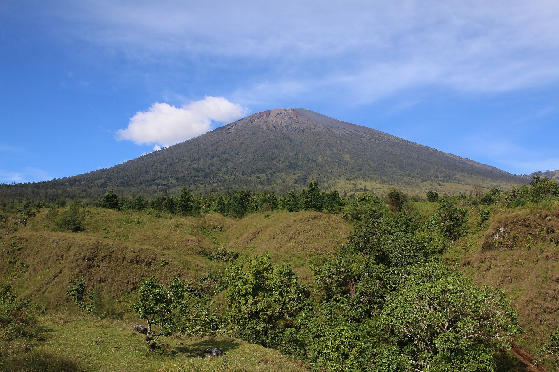
Rinjani reaches 3,726 m, which makes it the second highest volcano in Indonesia after Kerinci on Sumatra, and it dominates an island small enough to drive across in a morning.
The caldera around it covers roughly 50 km². Inside sits Segara Anak — Child of the Sea — a crater lake about 200 m deep, with natural hot springs on its shore. The trips that reach the lake stop at both.
Gunung Barujari, Finger Mountain, is the young cone that has grown inside the caldera through the eruptions of the last century. It is the part of the mountain that is still building itself.
The park around it
Taman Nasional Gunung Rinjani covers about 41,000 hectares inside the park boundary, with a further 66,000 hectares of protected forest outside it. The entrance ticket in every one of our packages is what pays into that.
In 2008 the Indonesian government put Rinjani forward to UNESCO as a geopark, which would have made it the first in the country.
An eruption record that still matters
The oldest eruption on record is 1847; before that the region was too remote for anyone to be keeping one. Activity between 1994 and 1995 grew the Barujari cone, and in April 2009 it woke again, sending ash as high as 8,000 m and closing the summit routes.
The ascent reopened that September, though the trails down into the caldera stayed shut longer. Further activity followed in 2010, with ash plumes measured at 5.5 km and an exclusion radius of 4 km around Barujari.
This is why a trekking plan is never only about your dates. The park authority closes routes when the mountain is active, and no operator can walk you up a closed trail. If that happens to your booking we will tell you, and move or refund it.
More guides
More on park & culture Park & Culture
Cultural tips for visiting Lombok
Short, practical manners for the villages below the mountain, from the people who live there.
2 min read
 Park & Culture
Senaru: the village, the waterfalls, and the walks
What there is to do around the northern trailhead besides the trek, and an honest warning about the guide touts at the falls.
4 min read
Photo credits
- Photo by Giovari max by Giovari max, licensed CC BY-SA 4.0.
- Photo by Chafidwahyu by Chafidwahyu, licensed CC BY-SA 4.0.
- Photo by Rindy Antika by Rindy Antika, licensed CC BY-SA 4.0.